Location
First location, 1898-1931: "Point is on the site of the first location of the Blue Quill's Indian Residential School (Saddle Lake-Blue Quill's Mission). The mission was situated 6 miles southwest of Saddle Lake and one mile north of the river. The point is on the site of the mission church. The cemetery is situated 300 metres north" (Orlandini, 2019).
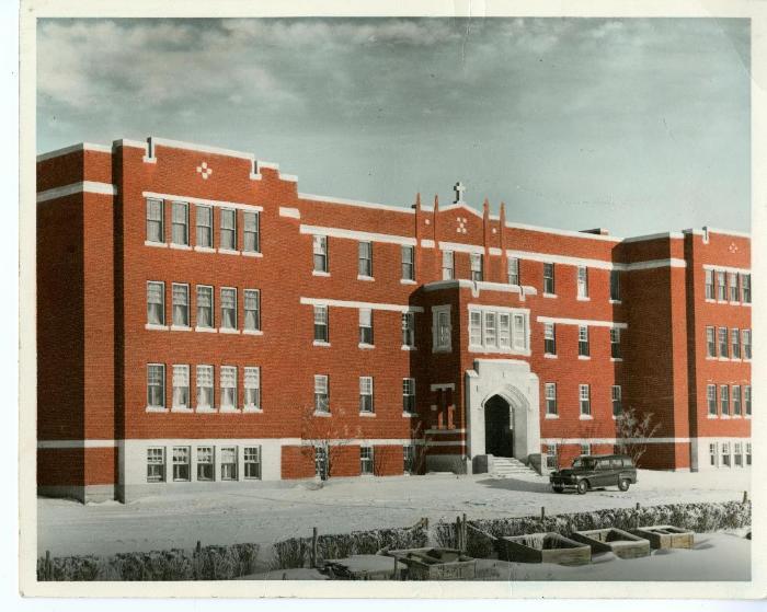
Second location, 1931-1990: "Point is on the site of the main building of the Blue Quills Indian Residential School. This site was the second location of the Blue Quills school. The buildings are now the Blue Quills First Nation's College" (Orlandini, 2019).Location Credit
Rosa Orlandini, Morgan Hite and Residential School Interactive Map. The school/hostel location data was collected by the Truth and Reconciliation Commission / National Centre for Truth and Reconciliation, Morgan Hite (Atlas of Indian Residential Schools of Canada), Stephanie Pyne (Residential Schools Land Memory Mapping Project) and Rosa Orlandini (Map and GIS Librarian, York University Libraries). The location data and associated attribute data was enhanced, revised and updated by Rosa Orlandini, in consultation with the Archivists at the National Centre for Truth and Reconciliation.Location Source
Orlandini, Rosa, 2019, "Residential Schools Locations Dataset (Shapefile format)",
https://doi.org/10.5683/SP2/FJG5TG, Borealis, V3, UNF:6:TTc1mMvx2BlBqBgIN05xVw== [fileUNF]