Location
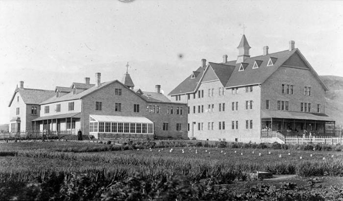
"Point is on the site of the main school and residential building that was built in 1935 and demolished in 1999. This was the third residential school building that was on this property. The location of the first industrial school building, built in 1884 to burnt down in 1904, is within 50 metres of the third school building. The second school building built in 1906 and burnt down in 1932 at the same spot as the third school building" (Orlandini, 2019). Location Credit
Morgan Hite and Rosa Orlandini. The school/hostel location data was collected by the Truth and Reconciliation Commission / National Centre for Truth and Reconciliation, Morgan Hite (Atlas of Indian Residential Schools of Canada), Stephanie Pyne (Residential Schools Land Memory Mapping Project) and Rosa Orlandini (Map and GIS Librarian, York University Libraries). The location data and associated attribute data was enhanced, revised and updated by Rosa Orlandini, in consultation with the Archivists at the National Centre for Truth and Reconciliation.Location Source
Orlandini, Rosa, 2019, "Residential Schools Locations Dataset (Shapefile format)",
https://doi.org/10.5683/SP2/FJG5TG, Borealis, V3, UNF:6:TTc1mMvx2BlBqBgIN05xVw== [fileUNF]