Location
Île à la Crosse,1897-1906: "Point on the site of school building that was used as the Ile à la Crosse Residential school until 1906. The school moved to Beauval in 1906. The Ile à la Crosse school reopened as a Métis Residential School in 1917. The building burnt down in the early 1920s. After 1920s there were several school buildings built on this same site and used as a Metis residential school until the 1970s" (Orlandini, 2019).
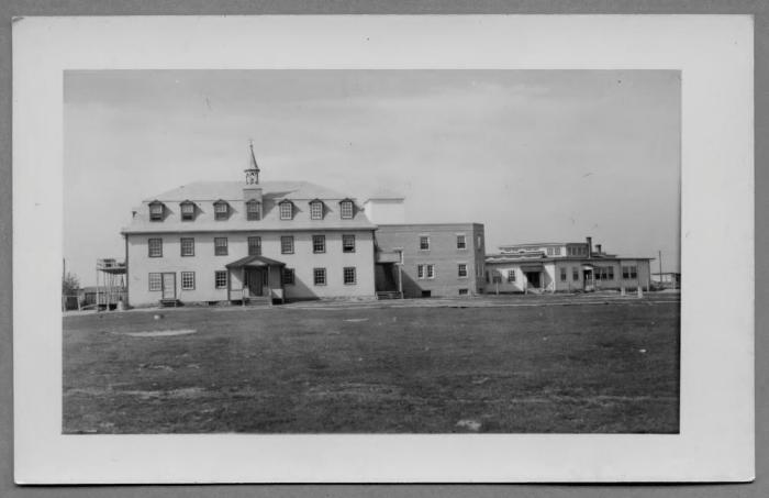
Beauval, 1906-1994: "Point is on the site of the second residential school building on the property (1932-1994). The original residential school building on this property was opened in 1906 and burnt down in 1927. It was located approximately 100 metres southeast, along Blec road near the landing. Early air photos indicate there is a graveyard located at 55.156038, -107.578898" (Orlandini, 2019).Location Credit
Morgan Hite and Rosa Orlandini. The school/hostel location data was collected by the Truth and Reconciliation Commission / National Centre for Truth and Reconciliation, Morgan Hite (Atlas of Indian Residential Schools of Canada), Stephanie Pyne (Residential Schools Land Memory Mapping Project) and Rosa Orlandini (Map and GIS Librarian, York University Libraries). The location data and associated attribute data was enhanced, revised and updated by Rosa Orlandini, in consultation with the Archivists at the National Centre for Truth and Reconciliation.Location Source
Orlandini, Rosa, 2019, "Residential Schools Locations Dataset (Shapefile format)",
https://doi.org/10.5683/SP2/FJG5TG, Borealis, V3, UNF:6:TTc1mMvx2BlBqBgIN05xVw== [fileUNF]