Location
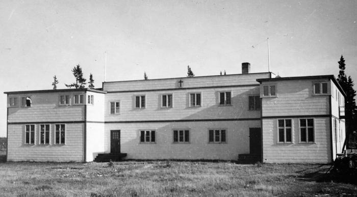
"Point is on the site of the classroom building of the Fort-George Church of England Residential School. The classroom building was built in 1959 and was torn down in the early 1980s. The building was located 150 metres east of the Anglican Church. To the west of the point was the site of the first school building and subsequent dormitory building that was built in 1963. The mission and community moved to the Chisasibi town site in 1981" (Orlandini, 2019).Location Credit
Rosa Orlandini. The school/hostel location data was collected by the Truth and Reconciliation Commission / National Centre for Truth and Reconciliation, Morgan Hite (Atlas of Indian Residential Schools of Canada), Stephanie Pyne (Residential Schools Land Memory Mapping Project) and Rosa Orlandini (Map and GIS Librarian, York University Libraries). The location data and associated attribute data was enhanced, revised and updated by Rosa Orlandini, in consultation with the Archivists at the National Centre for Truth and Reconciliation.Location Source
Orlandini, Rosa, 2019, "Residential Schools Locations Dataset (Shapefile format)",
https://doi.org/10.5683/SP2/FJG5TG, Borealis, V3, UNF:6:TTc1mMvx2BlBqBgIN05xVw== [fileUNF]