Location
First location, 1888-1893: "Point is on the approximate site of the first location of the Birtle Indian Residential School. The site may be adjacent or underneath the highway" (Orlandini, 2019).
Second location, 1893-1931: "Point is on the second site of the Birtle Residential School, specifically the site of the main school building that was opened in 1893 and closed in 1931" (Orlandini, 2019).
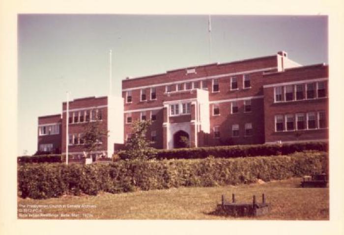
Third location, 1931-1970: "Point is on the main school building of the third location of the Birtle Indian Residential School. The ruins of the building remain on the site as of 2018" (Orlandini, 2019).Location Credit
Rosa Orlandini and the National Centre for Truth and Reconciliation. The school/hostel location data was collected by the Truth and Reconciliation Commission / National Centre for Truth and Reconciliation, Morgan Hite (Atlas of Indian Residential Schools of Canada), Stephanie Pyne (Residential Schools Land Memory Mapping Project) and Rosa Orlandini (Map and GIS Librarian, York University Libraries). The location data and associated attribute data was enhanced, revised and updated by Rosa Orlandini, in consultation with the Archivists at the National Centre for Truth and Reconciliation.Location Source
Orlandini, Rosa, 2019, "Residential Schools Locations Dataset (Shapefile format)",
https://doi.org/10.5683/SP2/FJG5TG, Borealis, V3, UNF:6:TTc1mMvx2BlBqBgIN05xVw== [fileUNF]