Location
First location of St. Cyprian's, St. Peter's,1890-1897: "Point is on the approximate location of the St. Peter's Mission School, the first location of the Peigan/St. Cyprian School. St. Peter's Mission was located near the mouth of Olsen Creek and about a mile to the east of the Agency buildings" (Orlandini, 2019).
Second location of St. Cyprian's, Queen Victoria Jubillee Home, 1897-1927: "Point is on the site of the Queen Victoria Jubilee Home (Peigan School). There is a monument in the field that marks the location of the school. This was the second location of the school that became St. Cyprian's" (Orlandini, 2019).
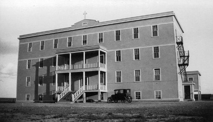
Third location of St. Cyprian's, St. Cyprian's,1927-1961: "Point is on the site of the main school building of Peigan/St. Cyprian Indian Residential School. The buildings no longer exist on the property" (Orlandini, 2019).Location Credit
Rosa Orlandini. The school/hostel location data was collected by the Truth and Reconciliation Commission / National Centre for Truth and Reconciliation, Morgan Hite (Atlas of Indian Residential Schools of Canada), Stephanie Pyne (Residential Schools Land Memory Mapping Project) and Rosa Orlandini (Map and GIS Librarian, York University Libraries). The location data and associated attribute data was enhanced, revised and updated by Rosa Orlandini, in consultation with the Archivists at the National Centre for Truth and Reconciliation.Location Source
Orlandini, Rosa, 2019, "Residential Schools Locations Dataset (Shapefile format)",
https://doi.org/10.5683/SP2/FJG5TG, Borealis, V3, UNF:6:TTc1mMvx2BlBqBgIN05xVw== [fileUNF]